About Syria
Tartus: The Waterfront and Historic City
Explore Tartus through historic stone frontages and dated waterfront photographs, then identify the address and evidence needed to research a particular home.
In this article
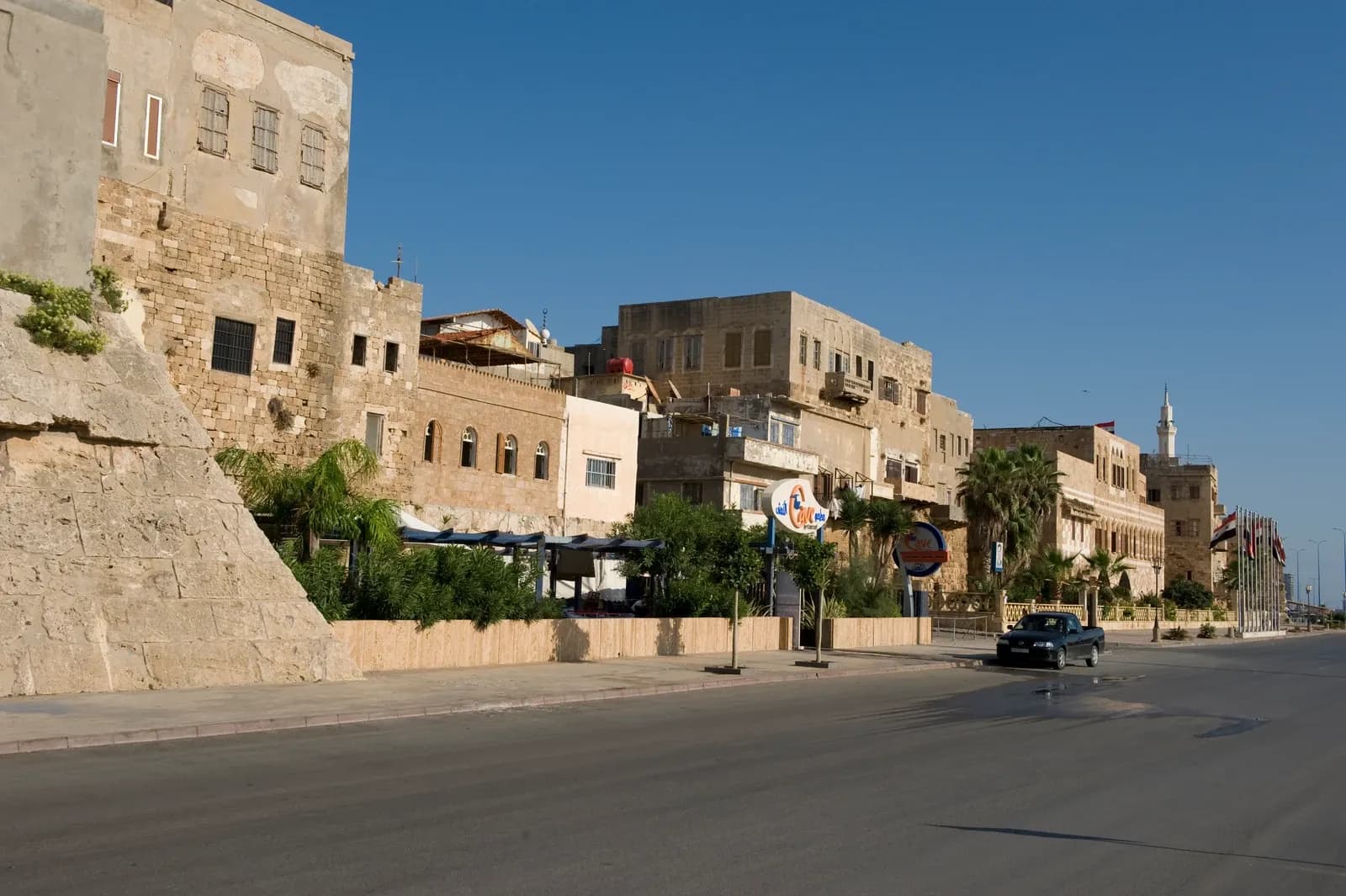

Tartus is easiest to understand by looking at the meeting of stone buildings, streets and the Mediterranean. A photograph of its historic seaward frontage tells one story; a broad view along the waterfront tells another. Both are useful, but neither describes the whole city or the qualities of a particular home. For someone researching Tartus, the first task is to locate the part of the city being discussed and work out what the photograph, heritage description or address actually covers.
This guide uses dated architecture and waterfront photographs to explain that distinction. It offers a way to investigate the urban setting without treating a scenic view as evidence of property condition, transport availability or investment performance. The historical material is a starting point for understanding place. A decision about accommodation needs a much closer view.
A historic frontage within a larger city
The Syrian submission on UNESCO's Tentative List for Tartus, dated 8 June 1999, concerns the historic city and citadel. It describes surviving defensive structures, including a keep, and other medieval architectural remains. This is a specific heritage subject, not a description of every neighbourhood carrying the Tartus name.
UNESCO's current Syria country record places Tartus on the Tentative List. That status means a place has been put forward for consideration; it does not mean the city is an inscribed World Heritage property. Keep the wording precise when comparing a travel article, a property advertisement and an official record. A heritage reference is also insufficient to establish restrictions or permission for work on an individual building.
The 2008 photograph accompanying this article shows substantial stonework beside later occupied buildings and a road. It helps a reader picture how historic fabric and subsequent uses can share a frontage. It cannot tell you which visible wall belongs to which period, who owns an entrance or whether a proposed alteration would be acceptable. Those questions require documents and appropriate local expertise.
Read the edge between buildings and water
An attractive sea-facing photograph can hide the most useful part of the setting: the space between the building and the shore. Trace that space carefully. Is there a road, pavement, planted strip or other intervening area? Does the picture show the entrance side of the building, or only its outward-facing elevation? A location described as waterfront may still involve several separate steps to reach the water.
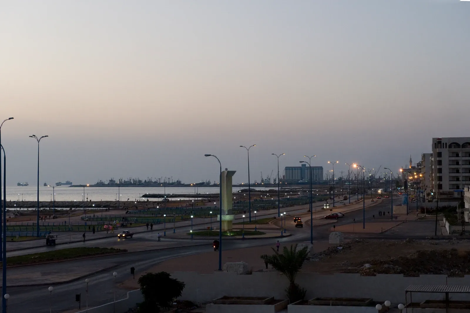
In the second archive photograph, made in September 2008, the photographer looks along a broad coastal road with the water and port structures beyond. It is an elevated view, not a drone survey. The image offers a relationship between several urban elements at that moment; it is not evidence that today's street layout, public access or activity is identical.
For a home with an advertised sea view, ask for a photograph from the specific room and floor. A view taken from a roof, another apartment or the opposite side of the street answers a different question. Record the direction, the window or balcony used and the date. Then compare the outlook with the entrance route and the other rooms. The view should be one feature in the assessment, with the daily arrangement of the home still in sight.

Look for the building's relationship to the street
Architecture is more than an isolated facade. A doorway can open directly onto a pavement, into a passage or through a shared courtyard. Upper floors may face different surroundings from the entrance. When looking at an unfamiliar address, ask for enough context to connect the doorway to the street rather than collecting several close photographs that could belong almost anywhere.
A useful remote sequence starts with a named street or recognisable junction, moves to the frontage and finishes at the entrance. Ask for permission before recording private spaces or people. The aim is to understand the route and arrangement, not to make a claim about the neighbourhood from a short clip. Note anything the sequence leaves out, such as stairs beyond a closed door or the path from the nearest accessible arrival point.
The same method applies to historic settings elsewhere. Our guide to Damascus through its historic centre explains why a city's cultural identity should be read alongside its finer urban grain. For Tartus, let the actual frontage and entrance carry more weight than an evocative label such as old town or near the sea.
Turn a promising setting into a usable brief
Imagine two hypothetical apartments described simply as coastal. One has a generous outward view but an entrance route that would need further investigation for your household. The other has a less dramatic outlook and a layout that may fit your routines more easily. Without information about those practical differences, the scenic description gives you little basis for choosing.
Write three requirements before requesting more photographs. These could be a room suitable for regular work, a manageable route through shared spaces and a particular kind of outdoor space. Specify what would demonstrate each requirement. A room needs dimensions and door positions; an entrance route needs context; a balcony needs evidence from the actual apartment. None of these is established by a city panorama.
Use How to Define Your Property Brief in Syria to make those requirements consistent across your shortlist. If you are comparing coastal cities, the Latakia setting guide provides a separate place reference. It does not supply a price comparison or a ranking of either market.
Keep historical context and current decisions legible
Build your Tartus research around four clear items: the exact address, the relevant heritage reference, dated contextual images and the questions still requiring current evidence. A historic stone frontage can explain why a place interests you. A waterfront photograph can orient you. Neither replaces a building assessment, an ownership review or current travel planning.
Before moving from browsing to a decision, make sure every answer belongs to the correct property. Keep the original source beside any historical statement and retain the date beside each photograph. Tartus rewards attention to the meeting of architecture and the coastal edge; careful research lets you appreciate that setting while understanding precisely what has, and has not, been established about a home.
Continue your research
Raqqa and Al-Hasakah: Starting Your Regional Research
Start Raqqa and Al-Hasakah research with clear geographic scope, dated photographs and place-name records before comparing evidence for specific homes.
Read more
Deir ez-Zor and the Euphrates: Geographic Context
Locate Deir ez-Zor through dated river photographs and urban research, then separate geographic context from the address and access evidence a home needs.
Read moreSources & review
Last reviewed:
PUT YOUR RESEARCH TO WORK
Start with a place.
Explore Syria’s cities and narrow your property search.