About Syria
Palmyra: Understanding Its Archaeological Significance
Explore Palmyra through its urban plan, cultural significance, dated photographs and archaeological resources, separating historical views from current conditions.
In this article
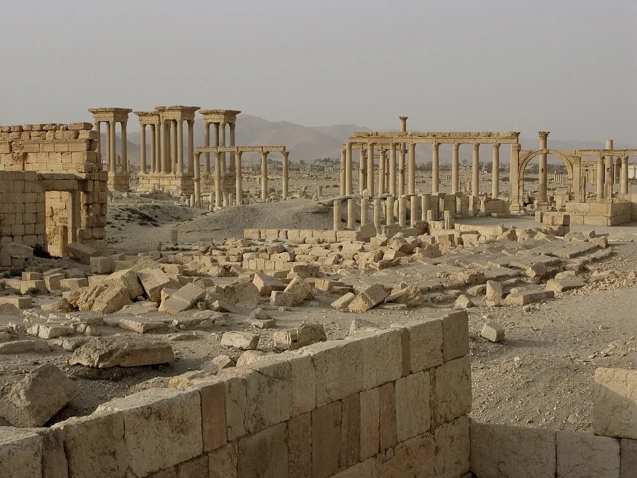

Palmyra's long rows of columns make an immediate impression. Understanding why the site matters takes a slower look: at the streets they define, the spaces those streets connect and the way architecture expresses contact between different cultural traditions. The archaeological interest lies in a city and its setting, as well as in individual monuments.
This introduction is for readers who want to make sense of maps, archive photographs and heritage descriptions before drawing conclusions from a striking image. The photographs on this page were taken in 2008 and 2010. They are historical records, including features that must not be assumed to survive in the same condition today. This page is not a travel itinerary or a statement about present access.
A city in an oasis setting
UNESCO identifies Palmyra as an oasis site in the Syrian desert, northeast of Damascus. Its World Heritage account explains the significance of architecture combining Greco-Roman forms with local traditions and Persian influences. Palmyra was inscribed in 1980. These points establish a starting framework: place, cultural interaction and the relationship between buildings and an urban plan. UNESCO's site record is the primary reference for that heritage description.
When looking at a photograph, ask where the desert setting ends within the frame and where the built space begins. A few isolated columns can look like sculptural objects. A wider view can reveal alignments, repeated openings and spaces between groups of structures. Neither view is complete, but each encourages a different question.
Keep the archaeological site distinct from the surrounding modern town. A shared place name does not make their buildings, boundaries or uses interchangeable. A heritage map is an appropriate tool for understanding a heritage property; it should not be repurposed as proof about the ownership or permissions of another address.
Follow the street before naming every monument
UNESCO describes the main colonnaded street and secondary streets as connections between major monuments and urban quarters. This is a useful way into the plan. Begin with the route, then examine how a theatre, a temple precinct or another public space relates to it. A list of impressive building names tells you less about city organisation than their positions in relation to one another.
In Vyacheslav Argenberg's August 2008 photograph, columns and surviving horizontal elements sit amid lower masonry and open ground. The frame gives an opportunity to compare upright forms with the traces nearer the ground. Resist completing every gap in your imagination. Some questions about the layout require an annotated plan or an archaeological interpretation, rather than confidence in what a single image appears to suggest.
Read the caption before using the picture as an illustration of a particular structure. A general colonnade view may include several features, while the source description names only the main avenue. Accurate identification means keeping the caption within that evidence instead of adding a more specific label because it sounds authoritative.
The theatre changes the scale of looking
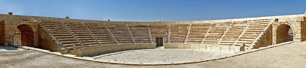
Bernard Gagnon's April 2010 panorama shows the theatre's seating from the stage. Its curved arrangement is easier to see in this wide composition than in a small detail photograph. As a visual exercise, compare the direction of the seating with the linear spaces in the colonnade view. One concentrates attention towards a performance area; the other encourages you to follow a route.
This comparison helps make urban form understandable without pretending that a photograph is a full reconstruction. The panorama does not show the whole archaeological setting, every approach to the theatre or the condition of features outside its frame. Its apparent clarity is partly the result of where the photographer stood.
For another approach to reading a theatre within a larger historic settlement, see the Bosra introduction. Compare the questions raised by the two sites; do not assume that similar architectural vocabulary means identical history or present conditions.

Archive views need a second time reference
The dates of these photographs are especially important. In January 2017, UNESCO reported destruction of Palmyra's tetrapylon and damage to parts of the theatre's proscenium, supported by reports and satellite imagery. Its dated damage statement provides a clear reason not to present older photographs as current scenes.
This is also a reason to distinguish parts of a monument. A photograph of seating and a report about the proscenium concern different features. Neither should be flattened into an unqualified statement that the entire theatre is intact or entirely gone. For present conservation work, look for a dated primary assessment covering the feature in question.
An older photograph remains valuable after damage: it documents a view, supports comparison and preserves information about an earlier state. Its usefulness depends on honest labelling. Removing the date would make the image easier to misread, while adding a dramatic claim beyond the source would weaken the explanation.
Use research maps with a purpose
In October 2025 UNESCO published an interactive archaeological research map. It describes interventions by national and international teams, developed with the French Ministry of Culture and the University of Lausanne in collaboration with archaeological missions. The map is a way to explore where research has taken place, rather than evidence that a route is open to visitors.
Choose one question before exploring: which part of the site is discussed, which team or project studied it and what period of work is represented? Follow the associated documentation where available. Keep an excavation date, a photograph date and a publication date in separate fields; they can refer to three different moments.
The same habit helps when reading the Ancient Villages of Northern Syria. A mapped heritage group, an individual ruin and a modern settlement need clear labels. The general principle travels well even when the archaeological evidence differs.
What a careful introduction should leave you with
Palmyra should become more legible, not simply more familiar-looking. You should be able to distinguish the broad setting from a monument, an archive view from a current condition report and a research resource from an access claim. Questions left open are part of an accurate understanding.
For regional context, the Central Syria collection connects this reading with other landscapes and cities. Keep that wider geography alongside the individual site's evidence. Palmyra's significance comes into focus through relationships between space, cultural expression and historical documentation, with careful attention to what has been recorded and when.
Continue your research
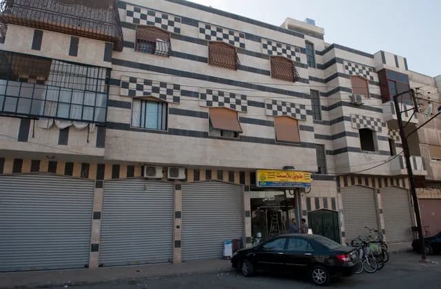
Homs: A City Guide for First-Time Property Researchers
Explore Homs through its streets, dated architecture photographs and urban research, then build an address-specific brief before comparing potential homes.
Read more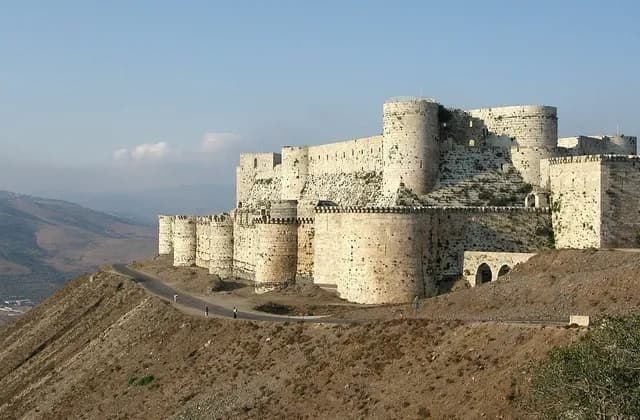
Homs Governorate: Separating City and Regional Research
Separate Homs city from governorate research with clear place names, dated regional photographs and practical ways to check the scope of your sources.
Read moreSources & review
Last reviewed:
PUT YOUR RESEARCH TO WORK
Start with a place.
Explore Syria’s cities and narrow your property search.