About Syria
Deir ez-Zor and the Euphrates: Geographic Context
Locate Deir ez-Zor through dated river photographs and urban research, then separate geographic context from the address and access evidence a home needs.
In this article
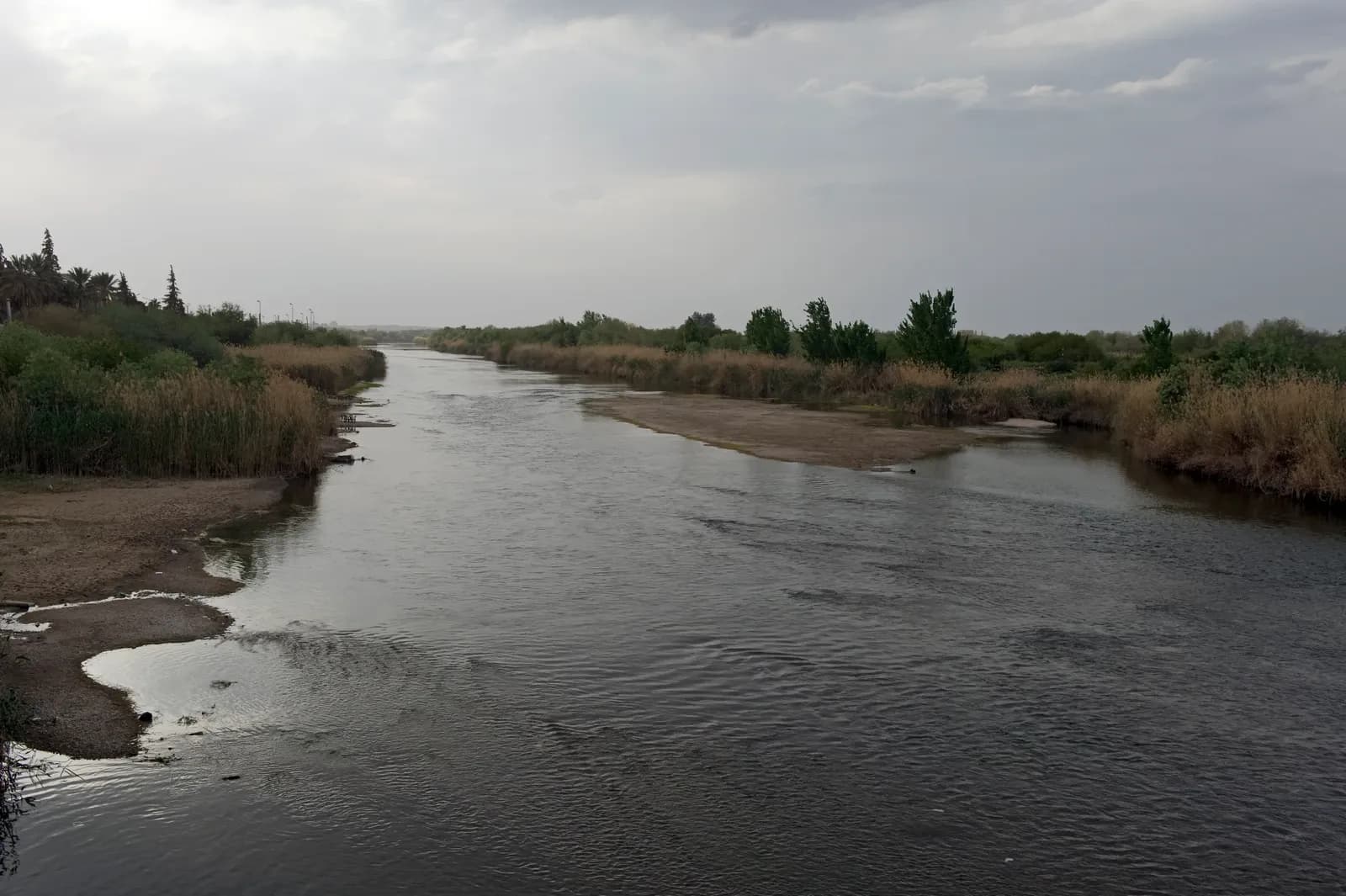

The Euphrates is a useful starting point for understanding Deir ez-Zor, but a river name is too broad to locate a home. Begin with the city, the relevant neighbourhood and the building entrance, then work out how the river relates to the journeys that matter to you. A photograph of greenery beside the water can explain a landscape. It cannot establish the address, the route to a workplace or the condition of an apartment advertised somewhere in the governorate.
This guide is for the early stage of research: making sense of place names and evidence before a property enters your shortlist. Its photographs are historical views. The geographic sources are dated too, so they provide orientation rather than a report on services, crossings or conditions today.
Put the city and the governorate on separate pages
Deir ez-Zor can refer to the city or the wider governorate. The distinction matters when a search result combines an urban photograph with a description of a different settlement. UNHCR's administrative map dated 17 November 2020 identifies Deir-ez-Zor as a governorate in eastern Syria. The map is a national reference; its scale does not identify residential entrances or resolve property boundaries.
Make your own location note more precise than that map. Record the Arabic place name supplied by the source, its English spelling, whether the source means the city or governorate, and the neighbourhood or settlement being discussed. Deir ez-Zor, Deir-ez-Zour and Deir Ez-Zour are spellings you will encounter in the sources used here. Keep the original wording alongside your preferred search label so that a spelling difference does not become a false location difference.
If someone sends an offer described only as “Deir countryside,” ask for the named settlement before comparing it with a city apartment. For broader orientation, our guide to checking the scope of governorate research shows why a regional description needs to be matched to the actual address.
Read the river photograph closely
The 2009 Euphrates photograph accompanying this article shows water, exposed shoreline, reeds and trees. It is a real image from Deir ez-Zor, photographed by Dick Osseman on 12 April 2009. Notice how little of a street network it reveals. That is useful information about the photograph's scope: a water-facing image may be attractive while leaving the relationship between a home and its surrounding streets entirely unclear.
When evaluating a different image supplied with an offer, ask where the camera stood and which direction it faced. Is the water visible from the apartment, from a shared roof, or from a separate public viewpoint? A caption saying “near the Euphrates” leaves all three possibilities open. Request an address-linked view before assigning value to the outlook.
Neither the apparent width of the water nor the exposed ground in an archive photograph establishes today's river level. They also do not answer questions about drainage, water quality or a building's suitability. Keep those as separate questions for appropriate current evidence and professional review.

Treat a historic crossing as an orientation clue
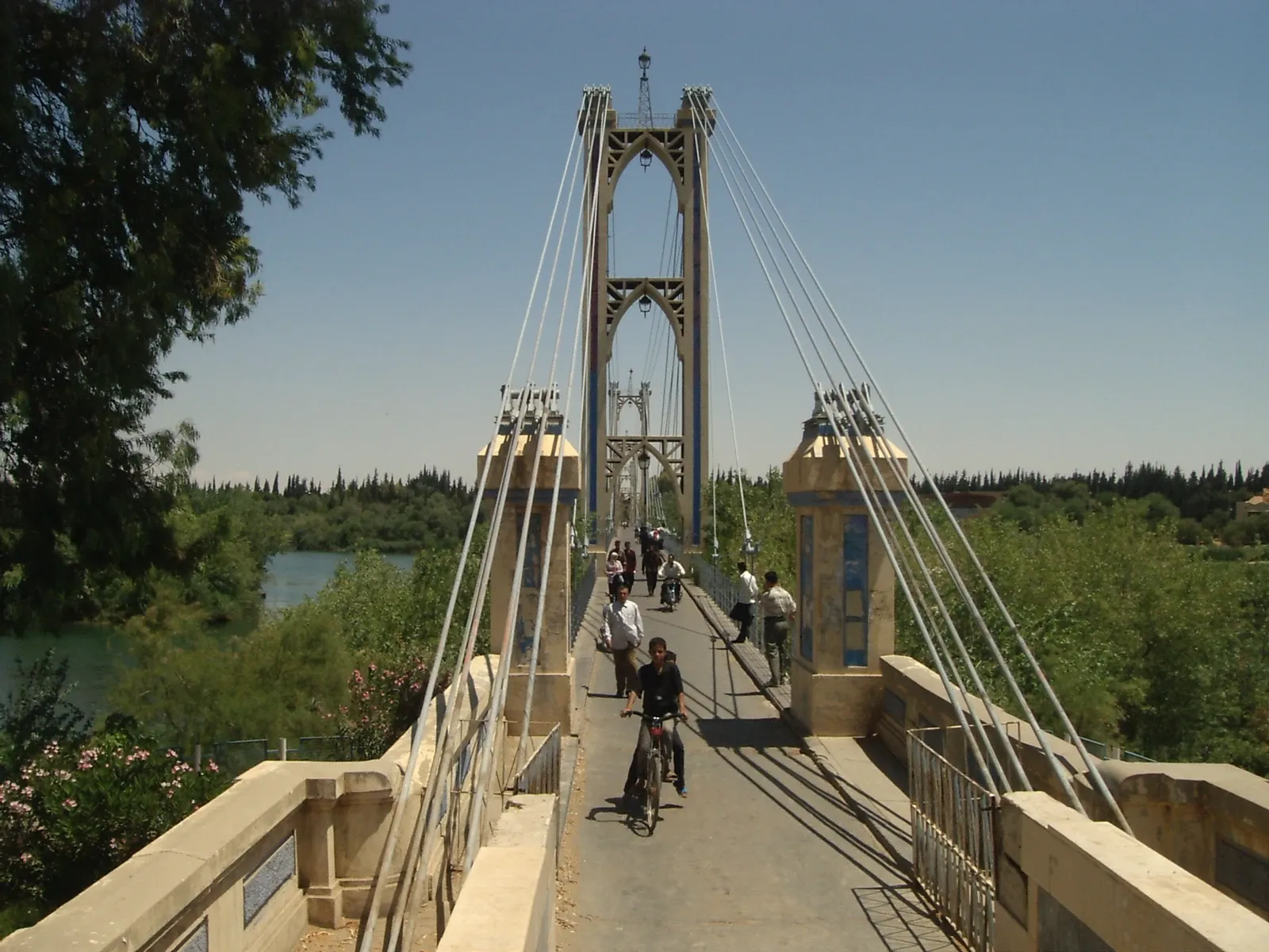
Our second photograph shows the suspension bridge with pedestrians and a cyclist in a 2008 archive view. Its source description and upload history disagree about the month, so the credit uses the year alone. The image records a particular earlier scene. It is not a photograph of a crossing checked for present use.
A memorable bridge can help you understand how a city was represented in older photographs, but it must not silently become the route used in a household plan. Draw the journey between two exact endpoints instead: the proposed entrance and a destination such as a relative's home. Note whether the route requires a river crossing, then request current, dated information about the route actually proposed. Do not calculate a daily journey from the span visible in this image.
This approach also helps when a seller uses a landmark as shorthand. “Near the old bridge” still needs a direction, distance and identifiable entrance. The same landmark can appear in descriptions of places approached from different sides.
What the dated city profile contributes
UN-Habitat's April 2015 Deir Ez-Zour City Profile explains that its study covered 19 neighbourhoods within the 2006 municipal boundary, including four peri-urban areas. Its methodology describes fieldwork during February and March 2015. That makes the report useful for understanding the area and period examined, rather than treating every place bearing the governorate's name as part of the same urban study.
The report also shows why neighbourhood-level information has a different scope from a city-wide summary. Its humanitarian assessments belong to that historical period. Do not transfer its population estimates, service descriptions or access findings into a current property comparison. Use a neighbourhood name encountered there as a research lead, with the spelling and date preserved, and seek current evidence for the specific building.
Turn “close to the river” into answerable questions
Imagine two fictional offers. One includes a river photograph and no entrance location. The other identifies a building, but its rooms face an internal street. The first offer has not yet demonstrated a river view; the second may be easier to investigate even though its photographs are less dramatic. These are examples of evidence quality, not actual properties or market recommendations.
For either offer, request a location pin tied to the entrance, photographs taken from the claimed viewing position, and a dated explanation of the ordinary access route. Ask which facilities the household needs to reach, rather than accepting “central” or “convenient” as complete answers. For building services, use the separate water and electricity questions instead of inferring supply from proximity to a river.
Finish with a short location paragraph: named city or settlement, neighbourhood, entrance evidence, relationship to the river, and the route still to confirm. Put unresolved items into your property brief. You will then have something concrete to investigate when an interesting home appears, while the Euphrates remains geographic context rather than a substitute for an address.
Continue your research
Raqqa and Al-Hasakah: Starting Your Regional Research
Start Raqqa and Al-Hasakah research with clear geographic scope, dated photographs and place-name records before comparing evidence for specific homes.
Read more
Arwad: Understanding the Island and Its Mainland Connections
Understand Arwad through dated island photographs and heritage sources, with practical questions about mainland connections and a specific home.
Read moreSources & review
Last reviewed:
PUT YOUR RESEARCH TO WORK
Start with a place.
Explore Syria’s cities and narrow your property search.